By Christine Borski,
Marine conservation student
The Belize barrier reef and the adjacent submarine shelf make up the world’s second largest reef system and the largest in the northern hemisphere. The Pelican Cayes group (Figure 1) is part of the South Water Caye Marine Reserve (SWCMR), an 117,878 acre marine protected area (MPA) and one of seven sites comprising the UNESCO Belize Barrier Reef Reserve System, a World Heritage Site since 1996 (http://whc.unesco.org/en/list/764, www.swcmr.org).
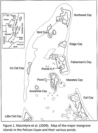
Figure 1 from Macintyre et al. 2009
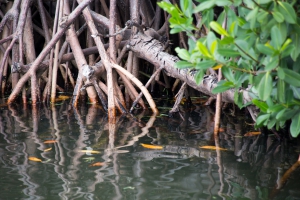
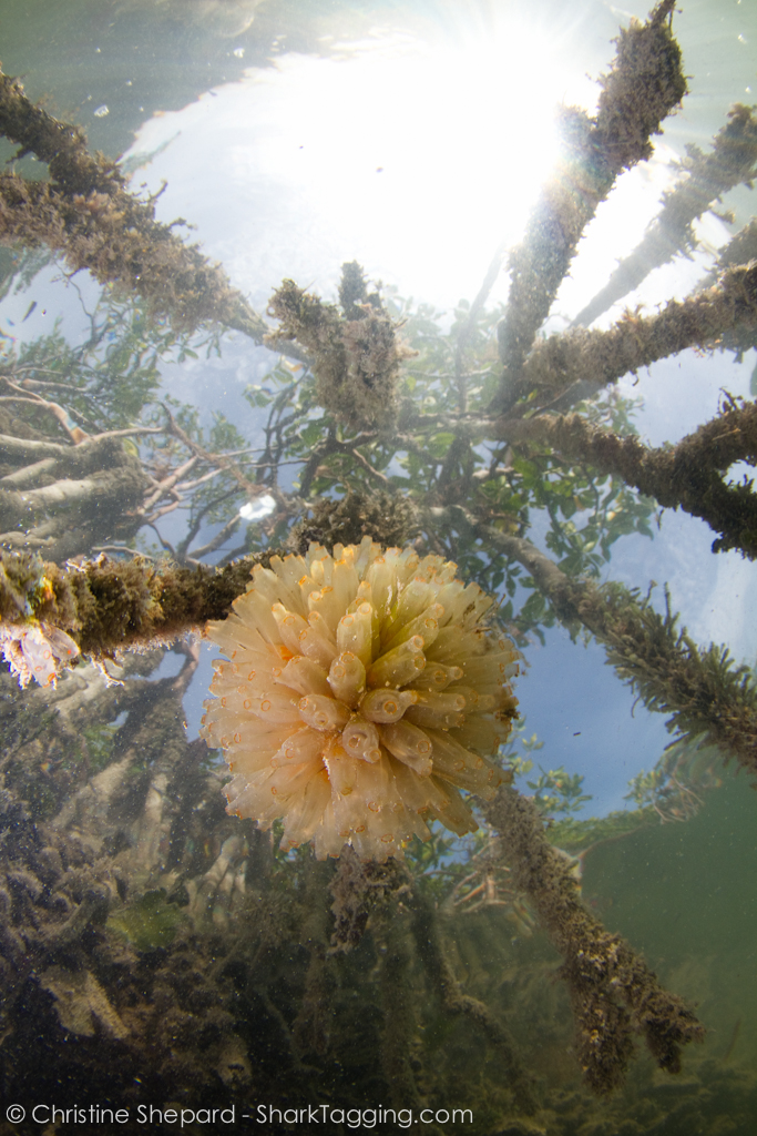
It is an oceanic coral reef boundary environment with deep (10-12m) lagoon-like semi or fully enclosed intertidal ponds encircled by steep coral ridges (Macintyre et al. 2000a). Red mangrove (Rhizophora mangle) communities have formed on these steep ridges, creating prop root substrate upon which rich communities have formed (Macintyre and Rützler 2000). The surrounding mangroves and coral ridges protect the ponds from prevailing winds and create a nutrient-enriched environment in which dinoflagellate phytoplankton populations can proliferate. These dinoflagellates are the primary food source of zooplankton, which includes fish larvae and juvenile fish.
At the time of its inscription, the World Heritage Committee and the Government of Belize recognized that SWCMR would be protected from development except for cayes with pre-existing leases and those that were privately owned. This exception would only apply within the Pelican Cayes to a small area less than one hectare at the southern tip of Northeast Caye.
Despite this recognition of protection, most of the SWCMR cayes have been leased for proposed resort developments since 1996, and large mangrove areas in the Pelican Range have been cut down and then covered with dredged marine sediment. The water in the sediment causes the fine particles to wash off into the pond and surrounding waters, creating high turbidity. The purpose of clearing and covering these coral islands with white sand is to ready them for development for the leisure and tourism markets.
In order to determine the amount of change in the Pelican Cayes since 1996, Macintyre et al. (2009) compiled field observational data, aerial photographs from both pre- and post-clearing efforts, and compared studies of dinoflagellate assemblages from within the Pelican range.
In March 2007, Macintyre et al. (2009) observed in Pond C of Manatee Caye areas of dead mangrove roots and a thick layer of sediment along the sides and bottom, burying the turtle grass (Thalassia) bottom communities. The organisms usually found living on mangrove roots in this area were absent. The pond was fringed with dead red mangroves. The land behind was recently cleared and covered with white marine sediment. The dredging work on Manatee Caye had finished at this time, although work on Fisherman’s Caye appeared to be underway since clear-cutting, large-diameter pipes, and a dredging vessel anchored off-shore of the island were seen.
From a series of aerial photographs taken since 2003, of all the cayes in the area, only Northeast Caye had shown signs of development prior to March 2003. By April 2006, all but one of the Bird Cayes had begun to be cleared. Areas of high turbidity along the edges of the ponds and outer shores of the mangrove islands were visible from the air.
Macintyre et al. (2009) also noted wide-spread cleared and filled areas on both Manatee and Fisherman’s Cayes, survey lines indicating more development, and an area of bare seabed near Manatee Caye signifying the location of the dredge operation (Figure 2). Of the 53.3 hectare area in the Pelican Cayes, 29% (15.4 ha) had already experienced clearing, burning and filling of the mangrove forests.
Macintyre et al. (2009) compared the diversity of dinoflagellate populations along the north side of Pond C to that found by Faust (2000) in the same location before clearing in May 1996. They found fewer live dinoflagellate cells than expected, with a 77.3% decrease in total species.
These declines in the physical and biological health of the Pelican Cayes are one example of a widespread problem. World-wide, mangroves are threatened with clearance for tourism, agriculture, urban development, aquaculture and resource exploitation (Alongi 2002, Giri et al. 2008). From 1950 to 2000, over 50% of the world’s mangroves have been lost with at least 35% from 1980 to 2000 (Viliela et al. 2001, MA 2005). At the current rate, mangroves are expected to be extinct in 100 years and with them, all the unique and important ecosystem goods and services they provide (e.g. biodiversity, filtration, carbon sequestration, nursery habitat, natural barrier) (Duke et al. 2007).
In 2000, mangroves were found to cover an area totaling 137,760 km2 in 118 different countries and territories, with approximately 75% found in just 15 countries (Giri et al. 2011). With the majority of the world’s mangroves under governmental control of just 15 countries, conservation measures by these governments must be effective in order to ensure the continued sustainable existence of what is left of the world’s mangroves.
How does this happen in an area supposedly protected as a marine reserve? According to Macintyre et al. (2009), most of the cayes within the Belize Barrier Reef World Heritage Site and the SWCMR have been leased or sold to foreign developers since 1996 simply by following standard procedures. Multiple permits are required before each stage of development can commence, and ignorance or misunderstanding of the protections afforded to MPAs could have occurred during any stage.
In 2008, the Forest Department of Belize issued a temporary moratorium on mangrove clearing in order to review these problems (http://forestdepartment.gov.bz/). The unique and biologically diverse ecosystems on the mangrove roots and the lagoon bottom of the Pelican Cayes ponds could be lost as a result of sediment suffocation. Additionally, the dredging efforts stir up clouds of bottom sediment which can travel via currents to nearby islands and reefs and cause smothering there. This sediment fill dredged from the adjacent sea floor can not only directly destroy corals and seagrasses by blocking sun light, but causes high turbidity, increases nutrient levels and releases contaminants. After development, untreated sewage and inadequately disposed solid waste can run off into the surrounding waterways and decreases overall water quality.
Besides the ecological threats, development on these in-filled islands may not be a good idea anyway. Subsidence due to rotting peat and the settling of the fill material, as well as the impacts from severe storms, could destroy any buildings on these islands and cause them to be abandoned. Construction efforts and habitation will also ensure perpetual pollution of the ponds from solid waste, sediment and sewage runoff, as well as contribute to the high turbidity of waters in adjacent marine communities. The beauty and high biodiversity of the mangrove islands and adjacent coral reefs is what enticed development in the first place. If these communities are destroyed, there will be no reason for continued habitation and development.
Altering mangrove ecosystems for residential, tourism and commercial markets adversely affects not just the health of coral reefs but also the biomass and viability of commercial fishes inhabiting the reefs, which are vital for both tourism and local livelihoods. The short term economic gains would not outweigh the long term losses. Adequate protection, management and enforcement of regulations governing these mangroves islands need to be re-evaluated and re-vamped. Potential developments on these sensitive ecosystems need to be properly managed for sustainable and low-impact practices.
REFERENCES
Alongi DM (2002) Present state and future of the world’s mangrove forests. Environ Conserv 29:331-349
Duke NC, Meynecke JO, Dittmann S, Ellison AM, Anger K, Berger U, Cannicci S, Diele K, Ewel KC, Field CD, Koedam N, Lee SY, Marchand C, Nordhaus I, Dahdouh-Guebas F (2007) A world without mangroves. Science 317:41-42
Giri C, Zhu Z, Tieszen LL, Singh A, Gillette S, Kelmelis JA (2008) Mangrove forest distributions and dynamics (1975-2005) of the tsunami-affected region of Asia. J Biogeogr 35:519-528
Giri C, Ochieng E, Tieszen LL, Zhu Z, Singh A, Loveland T, Masek J, Duke N (2011) Status and distribution of mangrove forests of the world using earth observation satellite data. Global Ecol Biogeogr, 20:154-159
Faust MA (2000) Dinoflagellate Associations in a coral-reef mangrove ecosystem: Pelican and associated cays, Belize. In: Macintyre IG, Rützler K (ed) Natural history of the Pelican Cays, Belize, pp. 133-150. Atoll Res Bull, No. 473
The Forest Department of Belize: Ministry of Natural Resources and the Environment. http://forestdepartment.gov.bz/ (accessed 3 Oct 2012)
MA (Millennium Ecosystem Assessment) (2005) Mille ecosystems and human well-being: synthesis. Island Press, Washington, DC
Macintyre IG, Goodbody I, Rützler K, Littler DS, Littler MM (2000a) A general biological and geological survey of the rims of ponds in the major mangrove islands of the Pelican Cays, Belize. In: Macintyre IG, Rützler K (ed) Natural history of the Pelican Cays, Belize, pp. 133-150. Atoll Res Bull, No. 430
Macintyre IG, Toscano MA, Feller IC, Faust MA (2009) Decimating mangrove forests for commercial development in the Pelican Cays, Belize: long-term ecological loss for short-term gain? Smithson Contrib Mar Sci, 38:281-290
Macintyre IG, Rützler K (eds) (2000) Natural history of the Pelican Cays, Belize. Atoll Res Bull, Nos. 466-480
South Water Caye Marine Reserve. http://swcmr.org/ (accessed 23 Sept 2012)
UNESCO World Heritage Centre: Belize Barrier Reef Reserve System. http://whc.unesco.org/en/list/764 (accessed 26 Sept 2012)
Valiela I, Bowen JL, York JK (2001) Mangrove forests: one of the world’s threatened major tropical environments. BioScience, 51:807-815
